विशेष लेख
Underwater Exploration
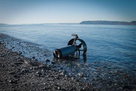
Oceanographers often employ drilling and coring methods to collect samples from the seabed. One such device, the gravity corer, replaces the sampler on the Baillie sounding machine with a weighted, open-ended tube that is triggered to descend and penetrate sediments upon contact.
Jack Lawson
लेखक
लेख परिचय
नीचे पूरा लेख पढ़ें।
अनुभाग
समाचार
Oceanographers often employ drilling and coring methods to collect samples from the seabed. One such device, the gravity corer, replaces the sampler on the Baillie sounding machine with a weighted, open-ended tube that is triggered to descend and penetrate sediments upon contact.
This corer can drill into the ocean floor to depths of approximately 33 feet (10 meters). Once retrieved onto the research vessel, the core is carefully extruded, and a geologist specializing in marine sediments examines the layers for scientific analysis. Certain advanced ocean drilling rigs can recover core samples from much greater depths—up to 4,900 feet (1,500 meters). Additionally, cores obtained from exploratory drilling for oil and gas, or from the foundations of offshore oil platforms, are studied by oceanographers and related experts.
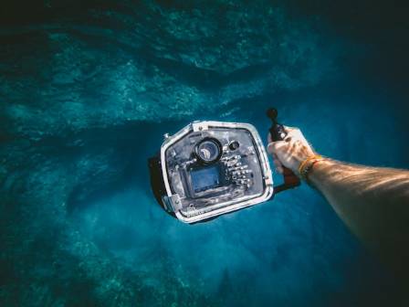
Beyond coring, oceanographers use a variety of instruments to measure and monitor the ocean. Flow meters gauge the speed of deep-sea currents, seismographs detect earthquake activity far from land, pressure sensors measure underwater pressure at different depths, and thermometers record temperature. These instruments are frequently mounted on sounding devices, as their data is most meaningful when referenced to depth. While research vessels carry many of these instruments, they can also be deployed on moored buoys. Modern research ships serve as sophisticated floating laboratories, equipped with advanced navigation systems, including GPS and computer-controlled positioning tools that maintain a fixed location at sea. A sonar beacon placed on the seabed often provides a reference point for precise positioning. Research vessels are also outfitted with an array of cameras—television, video, and still photography—as well as audio detection equipment.
Satellite technology has significantly enhanced oceanographic research. One important method, satellite altimetry, uses radar to measure the distance between a satellite and the ocean’s surface. Although oceans appear smooth from a distance, their surfaces actually display numerous broad depressions and elevations that mirror the underlying seafloor topography. These variations result from localized gravitational effects caused by underwater mountains and valleys. While the surface undulations are much less pronounced than the features on the seabed, they can still be measured accurately with satellite altimetry, which achieves a remarkable vertical resolution of just 1 inch (0.03 meters). Data from satellites such as the US Navy’s Geosat and the European Space Agency’s ERS-1 allow scientists to create detailed topographic maps of the world’s ocean basins. This is particularly valuable in remote deep-sea regions where direct depth measurements are scarce.
Without satellite technology, mapping the ocean’s surface at similar resolution would take roughly 125 years and hundreds of millions of dollars.
The applications of satellite altimetry are diverse. Variations in local gravity affect navigation for ships, submarines, and aircraft, and altimetry data allows navigators to account for these variations with course corrections. The maps also reveal subsurface features that influence ocean currents and help identify regions rich in marine life, aiding fishing operations. Geologists rely on the data to study plate tectonics, locate and examine underwater volcanoes, identify potential petroleum reserves, and analyze the structure of Earth’s oceanic crust.