विशेष लेख
How Coastal Deposition Forms Wonderful Sandy Beaches Across Our Shorelines
Coastal landscapes feature unique geographical areas known as beaches, which develop through the steady accumulation of sediment in the zones fluctuating between the daily high and low tides. These landforms typically emerge within protected environments such as inlets or sheltered coastal pockets nestled safely between prominent headlands. Whenever a significant alteration in the shape of the shoreline occurs, it slows down moving water, allowing various sediments to become trapped and gradually accumulate over long periods. When these sandy accumulations happen specifically at the innermost curve of a bay, geographers refer to them as bay head beaches.
Maya Collins
लेखक
लेख परिचय
नीचे पूरा लेख पढ़ें।
अनुभाग
समाचार
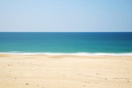
Coastal landscapes feature unique geographical areas known as beaches, which develop through the steady accumulation of sediment in the zones fluctuating between the daily high and low tides. These landforms typically emerge within protected environments such as inlets or sheltered coastal pockets nestled safely between prominent headlands. Whenever a significant alteration in the shape of the shoreline occurs, it slows down moving water, allowing various sediments to become trapped and gradually accumulate over long periods. When these sandy accumulations happen specifically at the innermost curve of a bay, geographers refer to them as bay head beaches.
These coastal zones are composed of varying mixtures of fine sand, rounded shingles, and larger weathered stones. The generation of these landforms relies heavily on specific marine dynamics. Constructive waves play a primary role in building up the shoreline rather than eroding it. During this process, the incoming surge of water, known as the swash, possesses significantly more energy than the retreating water, which is called the backwash. This imbalance ensures that geological material is forcefully driven up the shore. As the water eventually recedes toward the ocean, a substantial volume sinks directly into the porous sand, meaning the retreating current loses its strength and fails to pull the newly deposited material back into the sea.
The Role of Longshore Drift in Shaping Shorelines
Another critical factor in beach development is the phenomenon known as longshore drift, which describes the lateral transportation of sediments along the coast in a distinctive zig-zag pattern. This movement occurs because ocean waves typically strike the shoreline at an oblique angle dictated by prevailing winds, yet they drag material directly downward at a right angle due to gravity when they retreat. This continuous directional cycle steadily migrates sand and gravel along the coast until the progression encounters an obstacle like a rocky headland or a sharp shift in the orientation of the land, causing a massive structural buildup of material.

Understanding the Three Distinct Zones of a Typical Beach
A standard beach environment can be effectively categorized into three primary geographical segments. The first section is the foreshore, which represents the area positioned closest to the breaking waves. Within this lower boundary, observers can frequently identify distinctive formations like runnels and ridges, which appear as elongated sandy elevations and shallow depressions running completely parallel to the water line, carved out by the action of breaking waves.
Directly adjacent lies the middle shore, an intermediate zone where delicate ripple patterns are permanently etched into the sand by the gentle movement of the water. This region also showcases unique features called beach cusps, which are semi-circular or crescent-shaped hollows where coarser shingle transitions quite noticeably into much softer sand. Elongated and narrow mounds composed of stones and shingles, known as berms, typically develop here to mark the precise boundary separating the middle shore from the backshore, representing the highest point that standard high tides can reach.
The final section is the backshore, which occupies the highest ground and encompasses features like the storm beach, rising sand dunes, and steep cliff faces. The storm beach itself is a rugged area where unusually violent waves driven by severe weather have flung massive fragments of rock and debris far up the shoreline. Beyond this point, many beaches terminate in either natural or artificial sand dunes, which are large mounds of loose sediment stabilized against wind erosion by deep-rooted marram grass, while other coastlines end abruptly against solid clay deposits or towering rocky cliffs.
Famous coastlines across the globe, from the expansive strands in Europe to the iconic sun-drenched shores of Australia, perfectly illustrate these depositional features. When attempting to illustrate the structural layout of a beach in a geographical diagram, it is highly beneficial to clearly depict the exact placement and physical geometry of every single feature described above. Utilizing precise directional arrows or a clean explanatory key system will ensure clarity, and framing the completed illustration with a clear title will provide an excellent reference.

यह भी पढ़ें

The Evolution of the Golf Ball
Sophie Turner

Needle Felting Basics: Tools, Wool, and How to Begin
Magnus Ravenswood

छुट्टियाँ मनाने से आपकी सेहत कैसे बेहतर होती है
अर्जुन

रोलर स्केटिंग आपके लिए एकदम सही गतिविधि क्यों है, इसके 10 कारण
सौरभ

शीआन में तांग पैराडाइज़: क्या करें और कैसे जाएँ
ईशान

Most Advanced Humanoid Robots in the World
Sebastian Vale